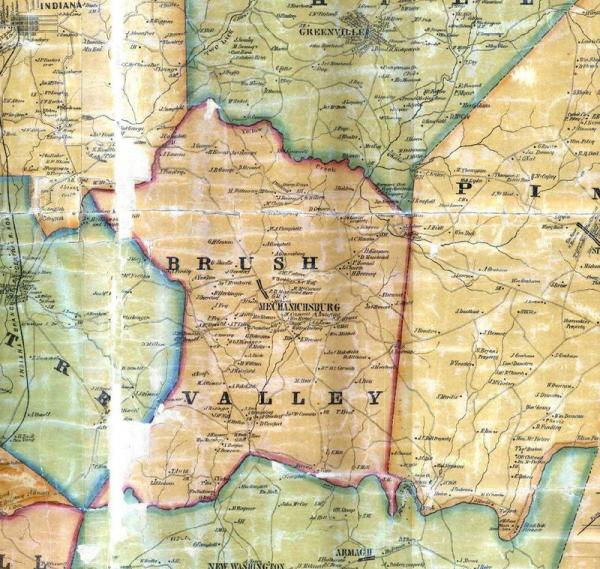
000836-01: Map, 1856
1856
Detail showing a portion of Pine Township, Indiana, Pennsylvania from the Peelor map of 1856. Indiana, Pennsylvania is shown upper left, in relation to Armagh, Pennsylvania, bottom center. The original properties of John Stewart [00249] and Charles Stewart [00260] were situated northeast of Armagh in Pine Township.
Source: Source: "Indiana County, Pennsylvania 1856 Peelor Map," images, Carla A. Currie, Treasures of the Past (http://freepages.genealogy.rootsweb.ancestry.com/~treasures/pa/indiana/maps/peelor1856/: downloaded 8 December 2009), Map of Indiana County, Pennsylvania; citing Map of Indiana County Pennsylvania from actual surveys by David Peelor. Published by William J. Barker, North Hector, New York, 1856.
Citation: Mike Voisin, iSeeAncestors (https://iSeeAncestors.com/tree/groups/public/media/si-00048-i249-10.php : revised June 12, 2023), Gallery.
Revised: June 12, 2023
Copyright © 2000-2023 Mike Voisin. All rights reserved.
