
 In a past posting I described how I located the homestead of my great-grandparents Albert and Mary Pohl near Turtle Creek, Pennsylvania. I’ve since found that Google Earth is another tool to further visualize the location. It is helpful in modernizing old maps to better understand where my ancestors lived.
What I did is add an overlay of an old map to the modern world shown in Google Earth. This allows you to see precisely where a road, building or property once stood in relation to what’s there now.
If you don’t already have Google Earth installed you can find it, of course, at Google. I will not explain how to install or use the features of Google Earth here. Instead I only give a brief overview of how you can use it in genealogy research.
First you must find or scan a digital copy of a map showing your ancestor’s property. This will most likely be a plat map, showing property boundaries, buildings and owner’s names. Try to use the latest of the early maps that still show your ancestors. That is, an 1860 plat map will usually be drawn more crudely than an 1875 plat. Likewise a 1915 plat will most accurately match the actual geography shown in Google Earth.
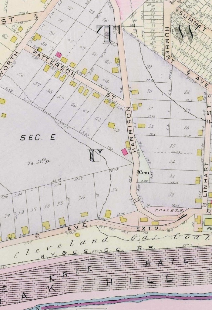
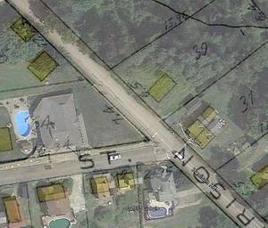
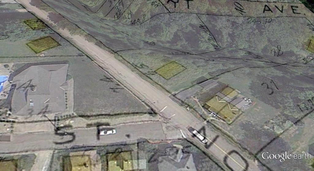
Once you have the map, crop it down to a smaller size that shows just the vicinity of your ancestor’s property. I found a 1915 plat and as shown above I cropped it to show just the intersection of Harrison Road with Patterson Street. The bigger the map, the more difficult it will be to get the images to match up when you overlay it.
In Google Earth, navigate to the area in question. Here I chose the intersection of Harrison Road with Patterson Street. Once you get to the general vicinity, I suggest resetting the tilt and compass so the view is not skewed. Do this with the View | Reset | Tilt and Compass command. Note this command is currently available only when you are not working with an overlay image.
Now select the command to add an overlay (Add | Image Overlay). Browse for the image of the plat map on your computer.
Set the image transparency so that you see both the Google Earth imagery and the road or property boundaries on the plat map. Then adjust the shape of the plat map image so it matches the actual geography. Do this by dragging the green lines at the corners or on the sides of the image. Move the entire overlay by dragging the crosshair lines at the center of the overlay.
With trial and error, you’ll be able to match up the plat map to the Google Earth imagery, like so:
Here, my great-grandparent’s homestead once stood at the yellow rectangle on lot 30 along Harrison Road, just past Patterson Street. Once you’ve matched up your overlay you can click the OK button. If you later want to reposition it, highlight your overlay in the list of places on the sidebar. Then click View | Properties. This will bring back both the dialog box and the green lines to reposition the image.
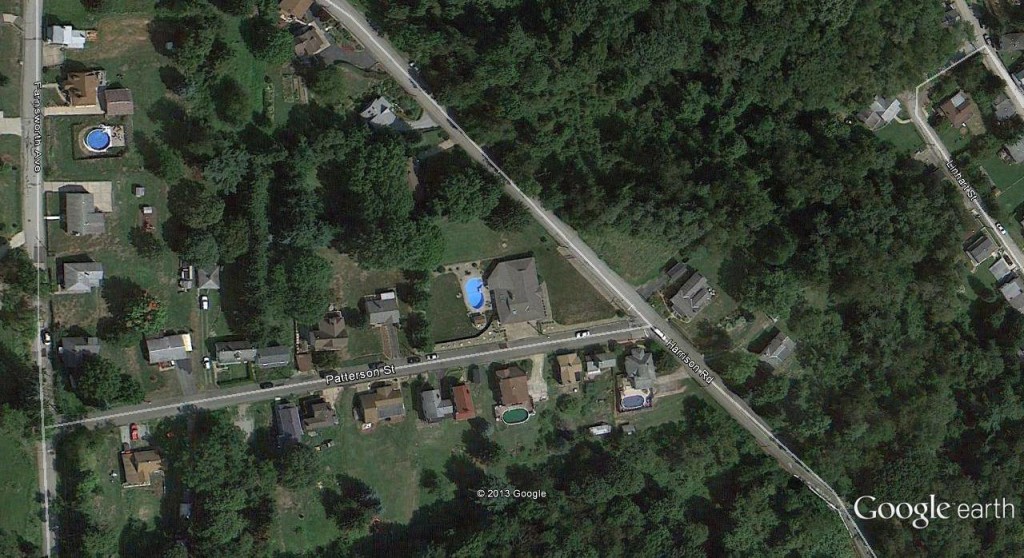
For greater insight, you can use the 3D feature of Google Earth to zoom in on the property. I notice that my great-grandparent’s house was on a very steep grade.
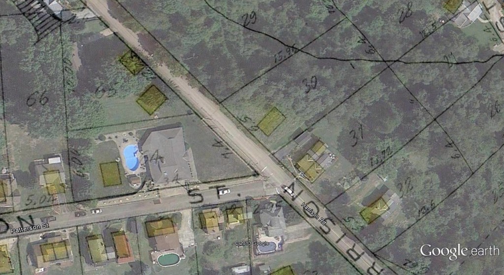
And another view:
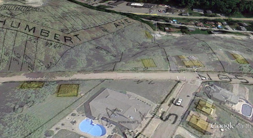
Keep in mind most flat plat maps didn’t take into account the terrain. Google Earth stretches the map, so Humbert Avenue shown above would probably have been more upon the hilltop.
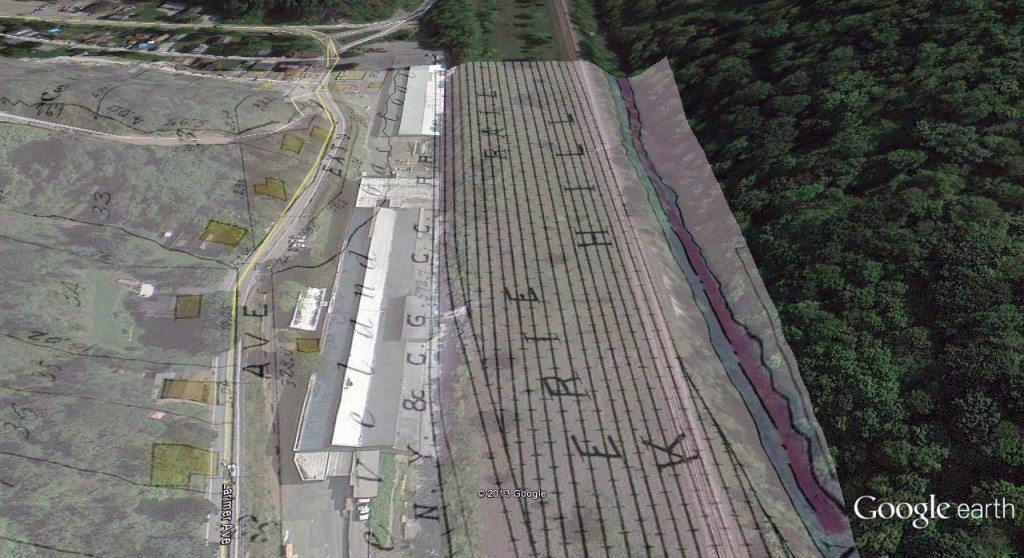
It’s also fun to see other features nearby. Although undoubtedly a big part of my ancestor’s world, this rail yard with several tracks no longer exists:
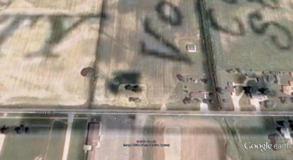
Google Earth is also useful in planning genealogy research trips. You can know exactly where to go when you visit a particular area, especially if a house no longer exists. Here I’ve mapped out the farmland where my great-grandparents, Joseph and Mary Voisin, once had a homestead:
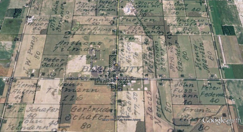
Their farm was two properties east of Beal City, Michigan. When I zoom in, I can see the original farmhouse would have stood at the black square in the lower left corner of the property, across the road from a parking lot:
All in all, Google Earth is a useful tool in genealogy.
Now do that with an 18th century plat where only a creek is named, and there are no roads. Sanborn fire insurance maps will only get you so far. Good luck.