Sep 052020
 
Colt

Is there a proverbial horse thief in your family tree? If you’re related to John Stewart (1821-1908), the answer is yes. John’s father was Major James Stewart, a well-respected member of the community, who served in the militia over forty years and was an elder of his church. He was also school director, tax collector, assessor, overseer of the poor, and justice of the peace.1,2

Continue reading »Footnotes
  1. C. T. Arms and E. White, History of Indiana County Pennsylvania 1745-1880 (Newark, Ohio: John Alexander Caldwell, 1880), Page 541, Major James Stewart.
  2. Joshua Thompson Stewart, Indiana County, Pennsylvania: Her People, Past and Present, 2 Volumes (Chicago, Illinois: J. H. Beers, 1913), Volume I, Pages 703, 706-707.
Jul 232016
 

newspaperWhat motivated my fourth great-grandparents John and Margaret (McFarland) Stewart to settle in the wilderness of western Pennsylvania near the end of the Revolutionary War?  There may be a very simple explanation:  They saw a newspaper ad.

Continue reading »

Apr 022013
 

My fourth great-grandparents, John and Margaret Stewart, were two of the first settlers in what would eventually become Buffington Township, Indiana County, Pennsylvania. John Stewart married Margaret McFarland in 1788 and by 1796 they had a son, my third great-grandfather, James Stewart.

I describe here how I used records available at the Pennsylvania Historical and Museum Commission (PHMC)1 and Google Earth to pinpoint the location of the original Stewart homestead.

Continue reading »

Footnotes

  1. Pennsylvania, “Copied Surveys, 1681-1912,” database and digital images, Pennsylvania State Archives, Land Records (http://www.portal.state.pa.us/portal/server.pt/community/state_archives/2887 : downloaded 9 December 2009), RG-17, Series #17.114, Copied Survey Book C-206, Page 221 and reverse, John Stewart, http://www.phmc.state.pa.us/bah/dam/rg/di/r17-114CopiedSurveyBooks/Books%20C1-C234/Book%20C206/Book%20C-206%20pg%20441.pdf; Pennsylvania Historical and Museum Commission, Bureau of Archives and History.
Mar 262013
 

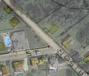
google-earth-00In a past posting I described how I located the homestead of my great-grandparents Albert and Mary Pohl near Turtle Creek, Pennsylvania.  I’ve since found that Google Earth is another tool to further visualize the location.  It is helpful in modernizing old maps to better understand where my ancestors lived.

What I did is add an overlay of an old map to the modern world shown in Google Earth.  This allows you to see precisely where a road, building or property once stood in relation to what’s there now.

Continue reading »

Sep 212011
 

Pohl Homestead

Albert and Mary Pohl Homestead

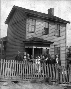
This is a case of genealogical serendipity.  I set out to determine the precise location of the house where my maternal great-grandparents, Albert and Mary Pohl, lived.  In this picture taken about 1909, the Pohl family posed in front of their house.1

From something unexpected, I uncovered a trail of bread crumbs that led me to their doorstep.

Continue reading »Footnotes

  1. The original is in the possession of Mike Voisin (mounted on cardboard, 5-15/16 by 6-15/16 inches).
Jul 092011
 

Those researching their ancestors in Pennsylvania know that county boundaries changed frequently in the years since 1682. To make these boundary changes easier to see, I animated them.

I used portions of the “Genealogical Map of the Counties” available at the Pennsylvania Historical and Museum Commission. I simply snipped the individual images in their sequence of state maps that show county boundaries and made a short flash animation.

Unfortunately these maps do not show cities and towns, but if you know the county you are interested in, you can see when it was created and how it changed over the years.

View an animated history of Pennsylvania Counties.